A new generation of mapping technology has quietly transformed the way real estate is researched, marketed, and sold. Geographic Information Systems—better known as GIS—once belonged almost exclusively to city planners, civil engineers, and environmental scientists. Over the last decade, however, these sophisticated mapping engines have migrated into Multiple Listing Service (MLS) platforms, putting vast layers of spatial intelligence in front of brokers and agents. The integration has moved far beyond the familiar pin-drop on a street map. Today’s GIS-powered MLS environment allows practitioners to visualize school district boundaries, overlay flood zones, gauge walkability, and even predict likely appreciation corridors, all without ever leaving their listing dashboard.
Understanding GIS and MLS Technology
Before exploring how the two systems work together, it is worth clarifying what each one does in isolation. An MLS, at its core, is a cooperative database. Participating brokers pool listings so other members may offer compensation, which fosters cooperation and broad market exposure for sellers. Traditionally, the MLS interface has relied on tabular data—square footage, bedroom counts, lot size, and photos. Spatial context existed, but it was limited to the property address and a simple street-level map.
GIS, on the other hand, is a framework for gathering, managing, and analyzing data rooted in geography. It links data to a map, integrating location with layers of information—demographics, zoning, terrain, or environmental risk. Analysts can query those relationships, identify patterns, and visualize trends that are nearly impossible to see in a spreadsheet. When GIS sits inside an MLS shell, every property record gains a multidimensional perspective.
The Evolution of GIS within MLS Platforms
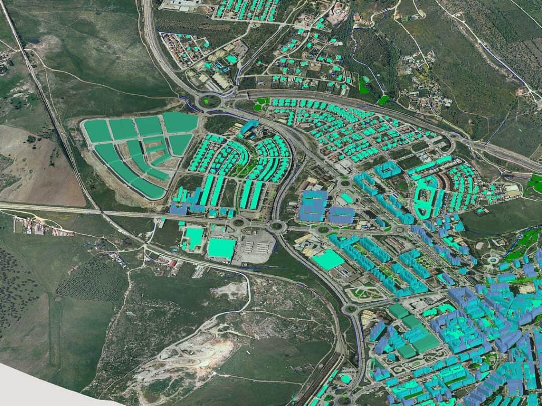
In the early 2000s, the earliest marriage between GIS and MLS amounted to little more than a clickable parcel outline showing lot dimensions. That alone felt revelatory compared with basic address pins. As broadband speeds improved and cloud computing matured, vendors began layering public records on top of listing data. Parcel boundaries, assessed values, and historical sales were now just a zoom or two away.
The real leap arrived once modern APIs allowed real-time data feeds from government and private sources. Flood insurance rate maps, FEMA disaster declarations, wildfire burn perimeters, and coastal erosion lines entered the conversation. Instead of pulling separate reports from local municipalities or federal agencies, agents could investigate a property’s natural-hazard exposure inside the MLS search pane. Buyers who once waited days for a binder of third-party disclosures could now gain that insight during the first showing.
As the technology matured, predictive analytics engines began drawing on census data, employment trends, and infrastructure investment plans. Many MLS systems now host “smart layers” that color-code census tracts by median household income, projected job growth, or migration patterns. A buyer can hover over a neighborhood and retrieve a five-year population forecast or a commute-time heat map, information that once required several subscription platforms.
Elevating Market Analysis for Realtors
Experienced agents have always relied on a blend of instinct and data. Comparable sales, absorption rates, and price-per-square-foot metrics still sit at the center of listing presentations. However, GIS layers add a sharper lens. Instead of telling a seller that homes near public transportation command a premium, an agent can illustrate the invisibly drawn one-mile radius from a light-rail stop and show the corresponding sale prices.
Along a coastal market, the same agent can toggle on sea-level-rise projections to reveal why properties located beyond a certain elevation line maintain value more consistently. Over time, anecdotal hunches about “the good side of town” yield to empirically verifiable storyboards.
When representing buyers, practitioners routinely draw polygon searches around school zones with high test scores or an area served by a particular utility. The client gains confidence because recommendations emerge from objective spatial data rather than subjective neighborhood lore. Contracts often materialize faster, and the inevitable question—“How did you come up with that number?”—is answered by an interactive map instead of a static comparable sheet.
Improving Listing Accuracy and Regulatory Compliance
One chronic headache in real estate has been the inadvertent misstatement of property attributes. A boundary error can spark an expensive legal dispute or derail financing. GIS mapping curtails many of these pitfalls. With parcel shapefiles sourced directly from county GIS departments, an agent can validate lot acreage instantly. If tax records say 0.83 acres but the parcel layer outlines 0.78 acres, the discrepancy surfaces before the listing goes live.
Environmental disclosures also improve. In jurisdictions where sellers must report flood risk or protected species habitat, MLS-embedded FEMA and Fish & Wildlife layers act as guardrails. Agents no longer lean exclusively on the seller’s memory or separate environmental reports. The map places the parcel in its exact relation to a floodplain or conservation easement, significantly reducing the margin of error.
Enhancing Client Communication and Engagement
Real-time mapping enriches the client experience in ways that text and still photos cannot. During a virtual meeting, an agent can share the MLS screen, zoom from the citywide view down to a specific block, and peel back layers one at a time. The conversation unfolds with a narrative arc: commute lines first, followed by school attendance zones, then local amenities like parks and bike lanes. This cascading visualization keeps buyers engaged, shortens decision cycles, and elevates perceived professionalism.
For sellers, GIS features help craft a compelling marketing story. A downtown condo listing may take advantage of a walkability index layer that quantifies the number of restaurants, grocery stores, and transit stops within a half-mile radius. Instead of a generic line about “close to everything,” the map serves proof that daily errands require no car. That concrete evidence can justify premium pricing in dense urban cores.
Case Illustration: A Mid-Size MLS in Action
Consider a mid-size metropolitan MLS that adopted a cloud-based GIS module in 2021. The platform feeds daily parcel updates from county assessors, quarterly demographic projections from the regional planning agency, and weekly wildfire hazard boundaries during peak fire season. A suburban listing in the outer north corridor illustrates the tool’s potency.
The sellers feared that their home, built near preserved woodland, would deter risk-averse buyers because of perceived fire danger. During the listing consultation, the agent toggled on the regional fire-hazard layer, which showed the property sitting outside the Very High Fire Hazard Severity Zone. At the same time, she activated an open-space layer depicting protected greenbelt trails within walking distance. The contrasting visuals framed the home as uniquely positioned: close to nature without falling inside the highest-risk polygon.
Marketing materials prominently featured screenshot excerpts from the GIS map, and QR codes in print brochures led visitors to an interactive version. The property received three offers in its first week, all citing the “best of both worlds” location. Without GIS, the agent would have relied on text disclaimers about risk zones and a subjective pitch about nearby trails—facts still correct, less vivid, and less persuasive.

Implementation Considerations for Brokerages and MLS Boards
While the advantages are clear, smooth adoption requires thoughtful planning. Chief among the prerequisites is data integrity. Parcel boundaries and zoning shapefiles must be refreshed frequently; stale datasets erode user trust. MLS boards often negotiate data-sharing agreements with county governments to secure nightly uploads. Security protocols must also satisfy privacy statutes because certain datasets—think household income or ownership details—carry confidentiality obligations.
Training represents the second pillar. Even seasoned agents may feel intimidated by multi-layer mapping dashboards. Most MLS organizations now schedule webinar series and in-office workshops, emphasizing practical scenarios rather than technical jargon. An illustrative workflow, such as mapping flood zones for coastal homes, allows agents to connect abstract capabilities to tangible daily tasks. Those who invest a handful of hours in guided training generally report a permanent shift in how they research listings and advise clients.
Frequently Asked Questions
1. What is GIS, and how does it integrate with MLS platforms?
GIS, or Geographic Information Systems, is a technology that captures, analyzes, and displays spatial data tied to specific locations. Within MLS (Multiple Listing Service) platforms, it integrates by linking property listings with detailed map layers, such as zoning, flood risks, or demographic trends, allowing agents to visualize and analyze data directly in their listing tools.
2. How do GIS tools benefit real estate agents in their daily work?
These mapping systems enable agents to provide precise market analysis by overlaying data like school districts or commute times on property locations. They improve listing accuracy, enhance client presentations with visual storytelling, and help identify value influencers like proximity to amenities, ultimately saving time and boosting credibility.
3. Can GIS mapping help with identifying environmental risks for a property?
Yes, it excels in this area. By incorporating layers from sources like FEMA or local agencies, agents can instantly see if a home falls within flood zones, wildfire hazard areas, or conservation easements, ensuring better disclosure compliance and informed client decisions.
4. Are there privacy concerns when using GIS data in MLS systems?
There can be, as some datasets include sensitive information like household income or ownership details. MLS providers must adhere to privacy laws and secure data-sharing agreements with government bodies to protect confidentiality while still offering valuable insights.
5. Do agents need special training to use GIS features in MLS platforms?
While the tools are becoming more user-friendly, some training is recommended. Many MLS organizations offer workshops or webinars focusing on practical applications, helping agents navigate layers and interpret data without needing deep technical expertise.
6. How does GIS mapping improve the client experience?
It transforms static data into interactive visuals, making complex information about neighborhoods or property risks easier to grasp. Clients can see real-time maps during consultations, fostering engagement, trust, and quicker decision-making with tangible evidence over vague descriptions.