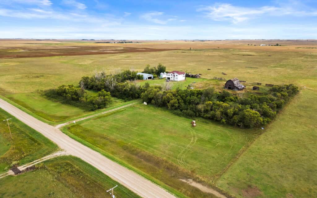
The Multiple Listing Service has been a cornerstone of the real estate world, primarily recognized for facilitating home sales in cities and suburbs. Yet, its adaptation to rural and farming properties marks a significant evolution, one that addresses the specialized needs of agricultural transactions. Far beyond a basic directory of available plots, these tailored platforms compile intricate data ranging from soil health to water entitlements, creating a vital resource for farmers, ranchers, and land investors. Delving into the unique aspects, advantages, and remaining hurdles of such systems reveals how they are redefining the way rural land changes hands.
Shortcomings of Conventional Real Estate Tools
Most real estate databases are built with urban buyers in mind, emphasizing details like floor plans, modern fixtures, and nearby conveniences. These elements, while crucial for a townhouse or bungalow, offer little insight into the worth of a rural expanse. A potential purchaser of a dairy operation, for example, requires information on forage availability, barn capacity, and local milk processing infrastructure. Likewise, an arable farmer prioritizes insights into irrigation history and terrain suitability. Standard systems rarely accommodate such depth, leaving professionals in agriculture to cobble together information from disparate sources or local contacts.
Genesis of Tailored Rural Platforms
To fill this void, regional real estate organizations joined forces with agricultural technology innovators to craft MLS solutions specifically for rural holdings. Early versions provided only marginal improvements over generic setups, but persistent input from industry stakeholders spurred substantial advancements. Today’s incarnations integrate extensive datasets, drawing from federal soil analyses, historical weather patterns, and regional resource allocation records. This unification streamlines a previously disjointed research effort into a cohesive, accessible interface for users at any experience level.
Core Information for Rural Parcels
While fundamental details like total land area and geographic coordinates remain essential, an MLS designed for agriculture incorporates far more granular specifics. Soil composition is a primary concern, as the difference between nutrient-rich topsoil and compacted subsoil can dictate crop success and property pricing. Interactive overlays within the system display these characteristics directly, eliminating the need to consult external agricultural studies.
Water availability carries similar importance, especially in regions governed by intricate allocation laws. Listings often detail the seniority of access rights, permitted withdrawal volumes, and any constraints on transferring those privileges. This transparency allows buyers to sidestep lengthy disputes with governing bodies post-acquisition.
Climatic factors are equally critical. Information on seasonal temperature ranges, freeze occurrences, and precipitation trends helps a specialty crop grower identify land that matches precise cultivation demands. Advanced setups even tap into data from nearby monitoring stations to offer localized environmental snapshots, ensuring decisions are grounded in accurate, site-specific conditions.
Expanding Market Reach for Landowners
A property owner aiming to sell a rural tract no longer has to lean on informal networks or niche publications to find buyers. Through a dedicated agricultural MLS, their assets gain visibility among corporate agribusinesses, environmental groups, and distant operators seeking to scale up. This wider audience often sparks competitive interest, particularly when the listing is backed by hard data rather than vague assertions. A soybean producer in Illinois, for instance, can entice a citrus investor from Florida by presenting clear metrics on irrigation infrastructure and growing seasons, reducing uncertainty in long-distance deals.
Enhancing Decision-Making for Buyers and Lessees
Individuals scouting for land purchases or rental agreements reap substantial benefits from these resources. Detailed records on water provisions and ground quality lessen the chance of post-deal regrets, such as discovering insufficient resources for intended use. For those pursuing lease arrangements, insights into prior land utilization—whether for grain production or livestock—ensure alignment with operational goals. Negotiations with owners or managers become grounded in concrete evidence, speeding up consensus and minimizing friction.
Facilitating Funding and Property Assessment
Financing for agricultural acquisitions often demands a level of scrutiny absent in standard home loans, requiring proof of land viability. An MLS incorporating soil charts, output histories, and resource rights directly aids in loan processing by equipping lenders with immediate access to necessary documentation. Valuation experts also find value in accessing comparable deals specific to a locale’s agricultural profile. This melding of transaction logs and productivity metrics results in swifter, more credible appraisals, aligning with the rigorous standards of farm credit institutions.
Addressing Legal and Conservation Constraints
Rural properties frequently come with regulatory intricacies not typically seen in urban markets. Some may be subject to permanent usage limits through preservation agreements, while others carry certifications mandating specific practices. Platforms built for agricultural listings highlight these obligations clearly within each record, shielding brokers and clients from unintended violations. Notations on protected ecosystems or critical habitats, for instance, warn of potential barriers to altering land use. Continuous updates from official sources ensure that such annotations reflect the latest standards, safeguarding decisions from outdated premises.
Technological Advancements Shaping the Future
Innovations like aerial imaging have started to amplify the functionality of these digital tools. High-definition captures from satellites or drones provide current snapshots of land conditions, from vegetation density to water distribution patterns. Cutting-edge algorithms further dissect this imagery to detect issues like soil depletion or invasive species encroachment. Though still in nascent stages for widespread use, these developments promise to drastically shorten the evaluation timeline, particularly for large investors assessing vast acreages from afar.
Ongoing Challenges in Rural Data Systems
Despite notable strides, certain impediments continue to slow full implementation. Internet reliability in isolated farming areas often lags, hampering timely data refreshes and access to detailed visuals. Many rural administrations still rely on physical records, necessitating labor-intensive digitization efforts that delay system accuracy. Additionally, expansive estates crossing several local boundaries complicate data integration due to inconsistent regional policies on taxation or zoning. Strengthening alliances between public offices and tech developers is crucial to resolving these structural bottlenecks.
The Enduring Role of Specialized Agents
Even the most advanced digital resources cannot fully substitute for the expertise of veteran land brokers. Their deep understanding of local peculiarities—from uncharted water access points to seasonal pest challenges—enriches the structured information in an MLS. Far from rendering them obsolete, these platforms empower agents to focus on strategic guidance, assisting clients with environmental considerations, legacy planning, and compliance with evolving standards.
Promoting Sustainability and Preservation Efforts
With heightened focus on ecological responsibility, conservation entities increasingly turn to agricultural MLS resources to identify land for restoration or climate mitigation projects. Search criteria like carbon storage potential or proximity to natural corridors help align acquisitions with environmental objectives. Conversely, producers embracing sustainable methods can spotlight features like organic crop rotation or minimal tillage, often appealing to impact-driven investors willing to offer higher bids for responsible practices.
Encouraging Overseas Capital Investment
Agricultural real estate has transcended local boundaries, drawing significant interest from international markets seeking stable, high-yield opportunities. MLS setups that support multilingual access and automatic unit conversions ease these global transactions. A foreign investor familiar with different measurement standards faces no confusion when exploring listings, as built-in tools seamlessly adapt data presentation for universal comprehension.
Frequently Asked Questions
-
What makes an MLS for agricultural land different from standard real estate platforms?
An agricultural MLS includes specialized data like soil composition, water rights, and climate metrics, which are critical for farming and ranching properties but irrelevant to urban or suburban homes. -
How does an agricultural MLS benefit landowners looking to sell?
It exposes their property to a wider audience, including institutional investors and distant farmers, increasing the likelihood of competitive offers through detailed, data-driven listings. -
What kind of information can buyers find in these systems?
Buyers access specifics on soil health, irrigation entitlements, past crop usage, and weather patterns, enabling informed decisions without relying on separate research or local hearsay. -
Can an agricultural MLS help with financing rural property purchases?
Yes, by embedding data on productivity, resource rights, and comparable transactions, it streamlines loan applications and appraisals, meeting the unique demands of agricultural lenders. -
Are there legal or environmental details included in these listings?
Listings often flag conservation easements, organic certifications, or protected habitats, helping users avoid regulatory pitfalls with up-to-date information from official sources. -
How does technology like satellite imagery enhance these platforms?
Satellite and drone imagery provide real-time views of land conditions, such as vegetation health or drainage issues, allowing buyers to assess properties remotely with greater accuracy.